March Online Auction ( Sale #287)
The prices are displayed as Base prices. On the lot page, the full prices arealso displayed.
Lot 403:
Description
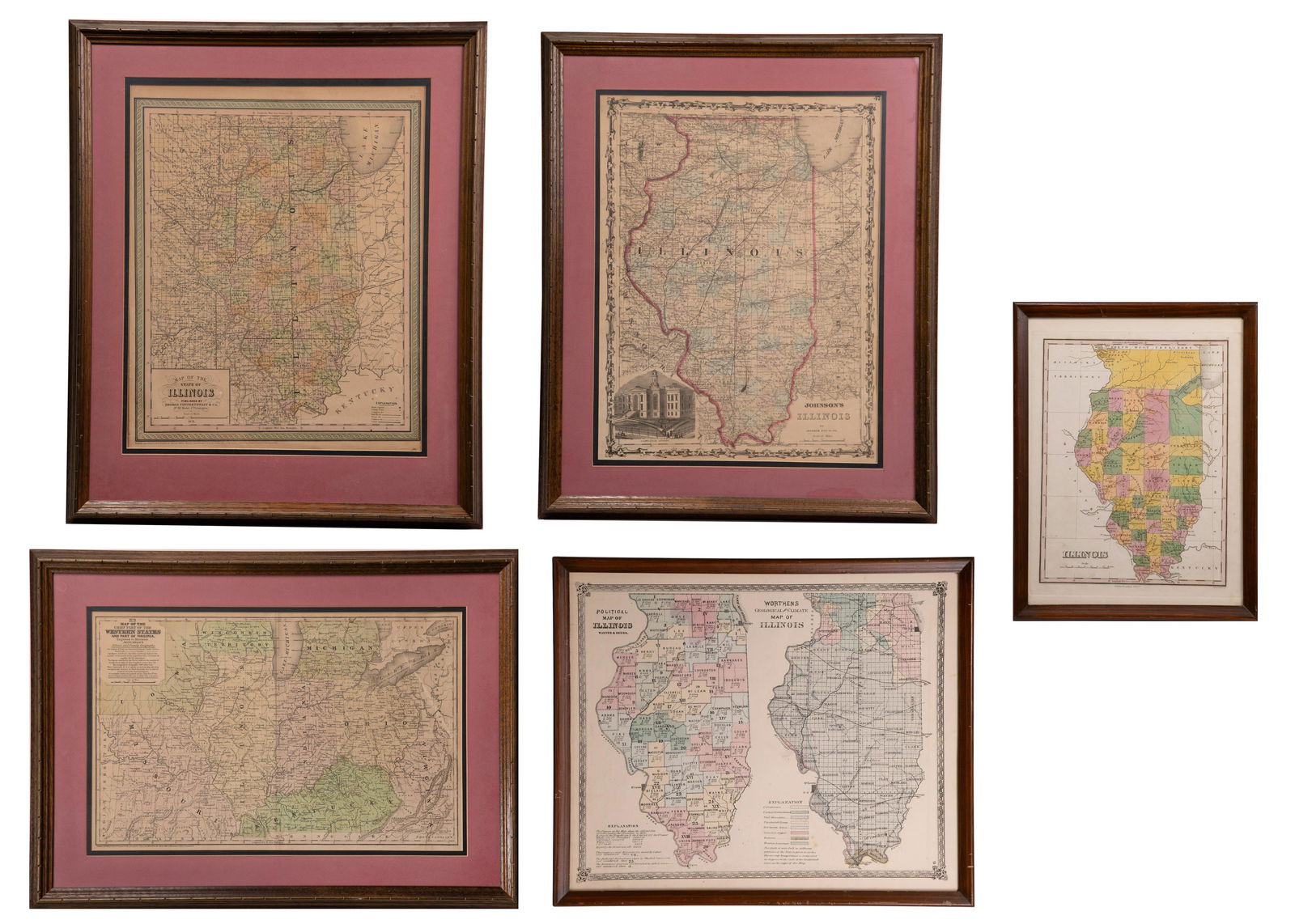
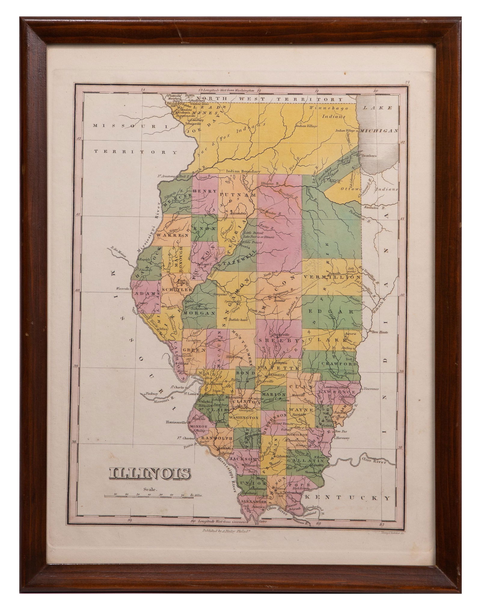
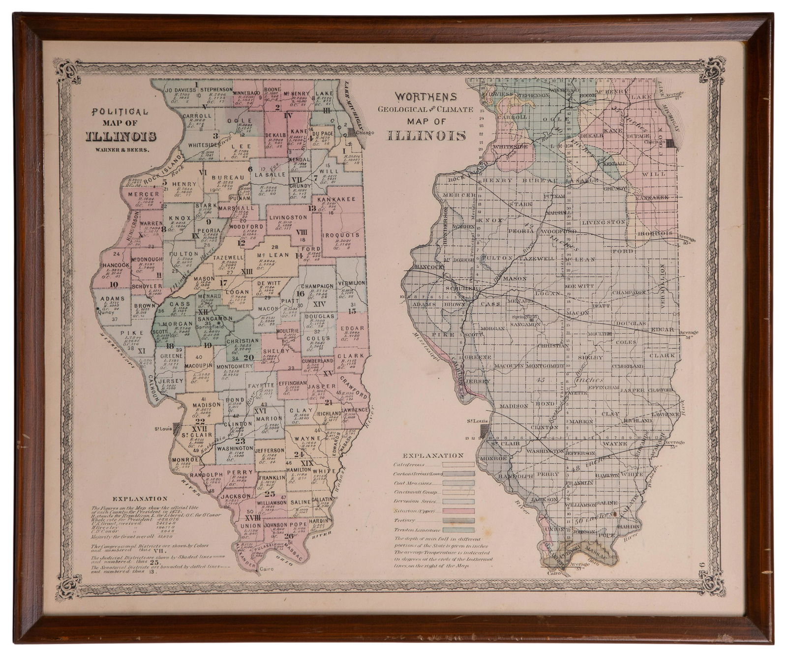
Illinois State Map Assortment
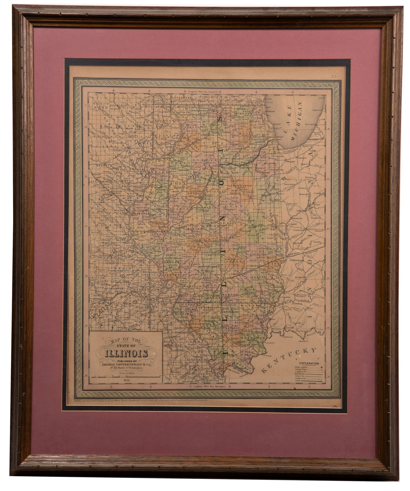
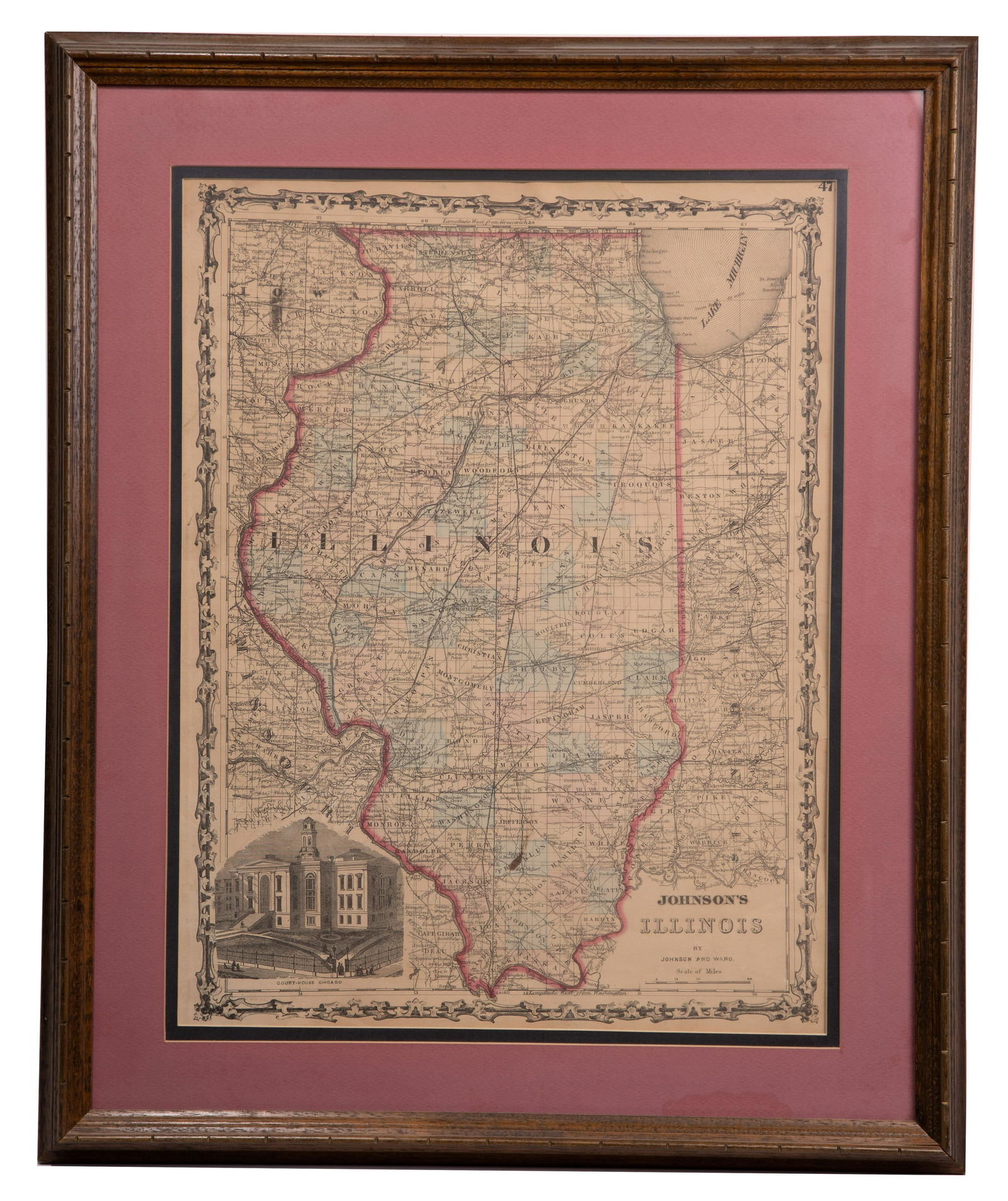
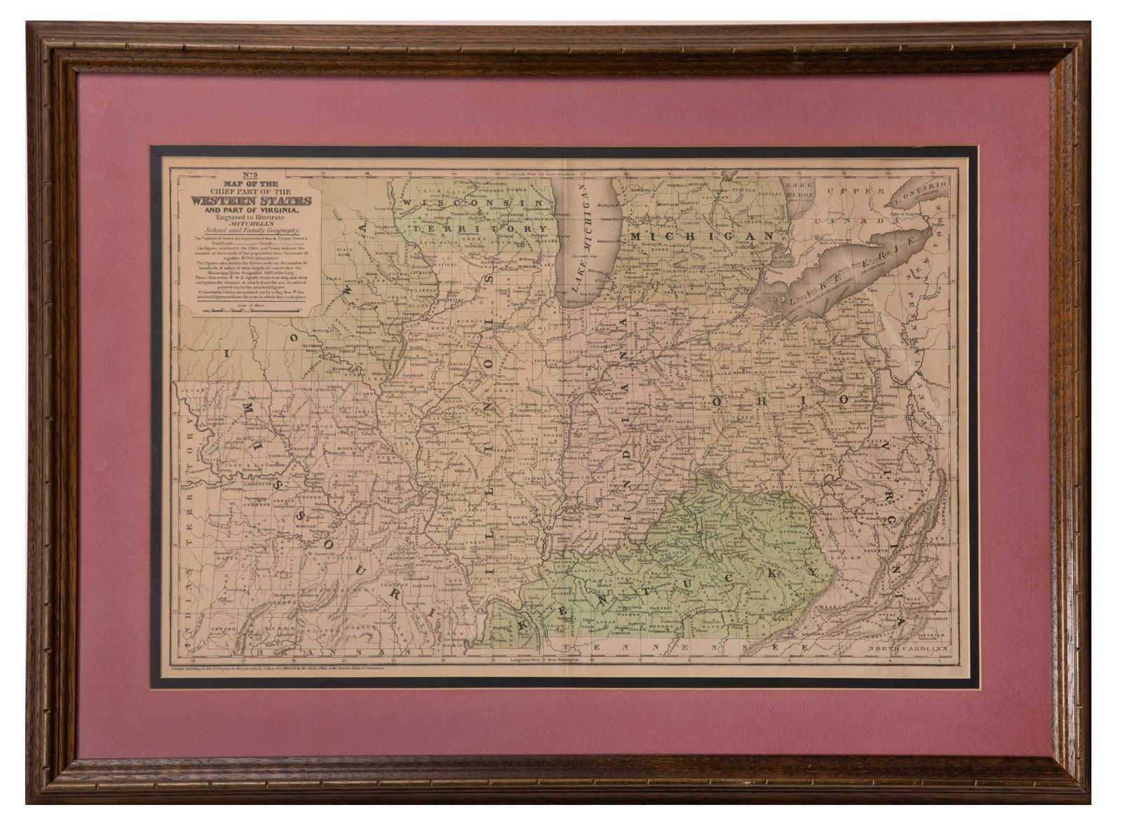
(5) items including ‘Illinois’ by Anthony Finley, Philadelphia c.1830, depicting land assigned to the Sac and Fox, Winnebago and Ottawa Nations before forcibly removed; ‘Map of the State of Illinois’ published by Thomas Cowperthwait, Philadelphia 1851; ‘Johnson’s Illinois’ by Johnson and Ward NY 1868, having the Court-House in Chicago illustrated; ‘Warner and Beers Political Map of Illinois and Worthens Geological and Climate Map of Illinois’ on a single sheet 1876; and ‘Map of the Chief Part of the Western States and Part of Virginia’ from ‘Mitchell’s School and Family Geography’ by S. Augustus Mitchell 1852; all framed behind glass
Property from: a River Forest, Illinois estate
Height: 16 3/4 inches, Width: 13 1/4 inches (sight, largest frame)
Frame Size: 23 inches by 19 inches
Condition: Very Good, overall light wear, paper toning; a chip to margin visible lower right of Cowperthwait; a tear upper right margin of Johnson and Ward; light spotting and smudges to Warner and Beers/Worthens; vertical crease at center of Mitchell’s; overall light wear to frames
Disclaimers: not examined out of frames
Category: Collectibles > Political
Estimated Sale Time: 3:40 pm CST
Shipping Status: Leonard Auction will directly ship this lot
Sales Tax: California (7.25%), Florida (6%), Georgia (8.5%), Kansas (6.5%), New Jersey (6.625%), New Mexico (5.125%), New York (8.875%), Pennsylvania (6%), Washington (10.5%)
Download High Resolution Photographs:
Photograph #1
Photograph #2
Photograph #3
Photograph #4
Photograph #5
Photograph #6
Last modified: March 11, 2022, 1:48 pm
Condition: Very Good, overall light wear, paper toning; a chip to margin visible lower right of Cowperthwait; a tear upper right margin of Johnson and Ward; light spotting and smudges to Warner and Beers/Worthens; vertical crease at center of Mitchell’s; overall light wear to frames
Dimensions: 16.75 x 13.25 in
Share this lot: